top of page
MANCHURIA
EMPIRE


GEOGRAPHY OF MANCHURIA EMPIRE
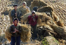
Manchuria is a name first used in the 17th century by Japanese people to refer to a large geographic region in Northeast Asia. Depending on the context, Manchuria can either refer to a region that falls entirely within the People's Republic of Chinaor a larger region divided between China and Russia. The region that falls entirely within modern China is now usually referred to as Northeast (Dongbei)in China, although "Manchuria" is widely used outside China to denote the geographical and historical region. This region is the traditional homeland of the Xianbei, Khitan, and Jurchen (later called Manchu 满族) peoples, who built several states within the area historically (however, no term for "Manchuria" exists in the Manchu language
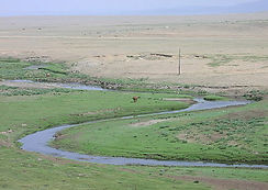
which originally referred to the area as the "Three Eastern Provinces" Manchuria consists mainly of the northern side of the funnel-shaped North China Craton, a large area of tilled and overlaid Precambrian rocks spanning 100 million hectares. The North China Craton was an independent continent before the Triassic period and is known to have been the northernmost piece of land in the world during the Carboniferous. The Khingan Mountains in the west are a Jurassicmountain range formed by the collision of the North China Craton with the Siberian Craton, which marked the final stage of the formation of the supercontinent Pangaea.

About
bottom of page